Ynys Môn and Ynys Gybi
Temple Or Shrine
Last Outpost of the Druids
Ynys Môn or Anglesey Island lies off the north-west coast of Wales and is separated from the Welsh mainland by the Menai Strait, a narrow channel of the Irish Sea which runs from south-west to north-east for some 15 miles (24 km) between Abermenai Point near Caernarfon, to Bangor, where after it widens into the flat expanse of Lavan Sands opposite Beaumaris, eventually to form the western cusp of Conwy Bay. Anglesey measures about 20½ miles (33 km) north-south by some 22 miles (36 km) east-west but is somewhat irregular in outline, having an area of only 276 square miles (714 sq. km).
Ynys Gybi or Holy Island is a smaller land mass of only 24 square miles (62 sq. km), which lies close off the western coast of Anglesey and is separated from the larger island by a narrow and muddy tidal strait, which runs for about 4 miles (6.5 km) north to south between Beddmanarch Bay and Cymyran Bay. Just ¼mile off the eastern coast of Anglesey lies a large rock which rises over 190 feet (58 metres) above sea-level. Named Ynys Seiriol in Welsh and formerly known as Priestholm after the monastic settlement there, the rocky outcrop is now a nature reserve inhabited in the main by a peculiar species of seabird whose presence have determined its modern name, Puffin Island.
Anglesey, Holy Island, Puffin Island and about a dozen more small rocks together formed a separate county up until 1974 when they were made part of Gwynedd. The estimated population of Anglesey was around 68,500 inhabitants in 1985, and Holyhead, the primary town and busy seaport at the north end of Holy Island had an estimated population of 13,000 in 1988.
Classical Accounts – Geographia
Among the first mentions of Anglesey in the classics we have the dubious report of Gaius Plinius Secundus or Pliny the Elder, a Roman of equestrian rank from Transpadane Gaul (Northern Italy). He was a tireless and prolific writer who died whilst trying to obtain a more-advantageous view of the catastrophic eruption of Mount Vesuvius which destroyed the Campanian towns of Pompeii and Herculaneum (among others) in 79AD. The following is the sum total of Pliny’s knowledge of Anglesey:
“… Between Hibernia¹ and Britannia² [lie] the islands of Mona, Monapia, Riginia, Vectis, Silumnus and Andros;³ …” (Pliny Natural History IV.xvi.103.)
- Ireland.
- England and Wales.
- Respectively: Anglesey, Man, Racklin, White-horn, Dalkey and Bardsey (source LOEB).
Giving us much the same information is Claudius Ptolemaeus, a Greek astronomer and geographer who flourished in the mid-second century AD. In the second book of his great work on geography, the last entry under the heading Albion Island of Britannia reads:
… Toward the east of Hibernia are these Insulae; Monaoeda Insula¹ 17*40 61°30, Mona Insula² 15*00 57°40, Adru³ which is barren 15*00 59°30 and Limnu which is barren 15*00 59°00.” (Ptolemy Geography II.i.)
- Isle of Man.
- Anglesey
- The remaining two islands may be equated with the Andros and Silumus entries of Pliny, respectively Bardsey and Dalkey (vide supra).
Classical Accounts – Historia
The Initial Assault on Anglesey
After the initial invasion of lowland Britain under Aulus Plautius, and the campaigns of his successor Ostorius Scapula against Caratacus and the tribes of South Wales, the next Roman governors of Britain, Didius Gallus and Quintus Veranius, were less aggressive in their approach and spent most of their terms of governorship consolidating the ground already won. Veranius died in office after only a single campaign season and was succeeded in late 60AD by Suetonius Paulinus, a seasoned general fresh from recent victories in Armenia:
… Suetonius Paulinus … had two successful years, reducing tribes and strengthening garrisons: presuming upon which success, he attacked the island of Anglesey,¹ a rallying-point of rebellion, …” (Tacitus Agricola xiv.3.)
- Tacitus uses the words Monam insulam.
The Roman historian Cornelius Tacitus supplies us with the most detailed account of Paulinus’ attack on Anglesey in another of his works:
xxix “… [Suetonius Paulinus] prepared accordingly to attack the island of Mona, which had a considerable population of its own, while serving as a haven for refugees; and, in view of the shallow and variable channel, constructed a flotilla of boats with flat bottoms. By this method the infantry crossed; the cavalry, who followed, did so by fording or, in deeper water, by swimming at the side of their horses.
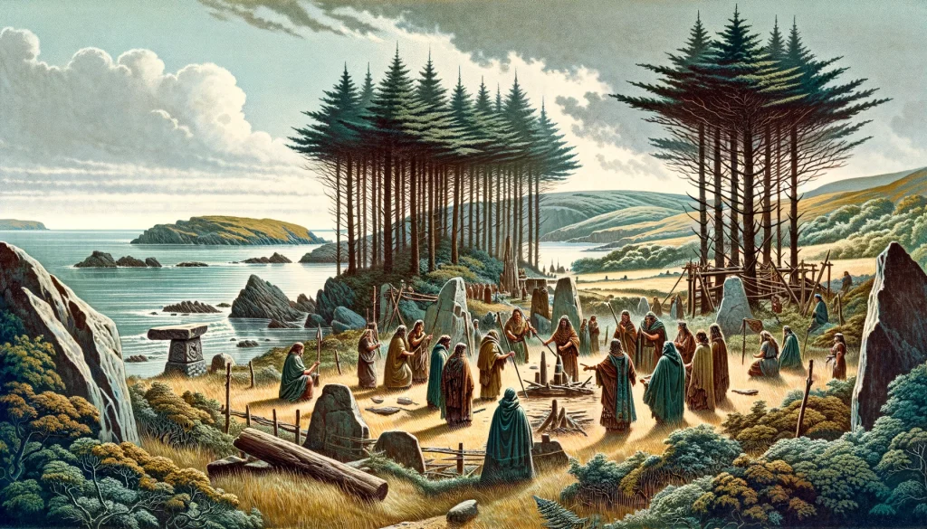
xxx “On the beach stood the adverse array¹, a serried mass of arms and men, with women flitting between the ranks. In the style of Furies, in robes of deathly black and with dishevelled hair, they brandished their torches; while a circle of Druids, lifting their hands to heaven and showering imprecations, struck the troops with such an awe at the extraordinary spectacle that, as though their limbs were paralysed, they exposed their bodies to wounds without an attempt at movement. Then, reassured by their general, and inciting each other never to flinch before a band of females and fanatics, they charged behind the standards, cut down all who met them, and enveloped the enemy in his own flames. The next step was to install a garrison among the conquered population,² and to demolish the groves consecrated to their savage cults: for they considered it a pious duty to slake the altars with captive blood and to consult their deities by means of human entrails. – While he was thus occupied, the sudden revolt of the province was announced to Suetonius.” (Tacitus Annals XIV.xxix-xxx.)
- Interestingly, the phrase ‘adverse-array’ contains the origins of the Modern Engligh word adversary, meaning ‘opposing forces’, or ‘enemy’. Not exactly Roman Britain, but worthy of note.
- Probably at Segontium (Caernarfon), or possibly near Bangor, though evidence is lacking.
The site of Paulinus’ attack on Anglesey is thought to have been on the Penmon Peninsula in the eastern corner of the island, perhaps on the beaches near Beaumaris, overlooked nowadays by the 13th-century castle.
Cut Short by the Rebellion of Boudicca
The Greek historian Cassius Dio continues the historical narrative:
… Buduica¹ led her army against the Romans; for these chanced to be without a leader, inasmuch as Paulinus, their commander, had gone on an expedition to Mona,² an island near Britain. This enabled her to sack and plunder two Roman cities,³ and, as I have said, to wreak indescribable slaughter. …” (Cassius Dio History of Rome LXII.7.)
- In the original Greek: Βουδουικα.
- In Greek: Μωνναν or Mônnan, Mona.
- The Roman colonia at Camulodunum (Colchester, Essex) and the municipium of Verulamium (St. Alban’s, Hertfordshire); London was also razed to the ground but at the time had no official civil status and therefore did not warrant a mention.
While Paulinus was smashing the last pockets of resistance on Anglesey, the Iceni tribe in East Anglia were incited to revolt by their queen Boudicca (or Boadicea), and were joined in rebellion by their neighbours, the Trinovantes.
Now it chanced that Paulinus had already brought Mona to terms, and so on learning of the disaster in Britain he at once set sail thither from Mona. …” (Cassius Dio History of Rome LXII.8.)
Paulinus very likely sailed from Anglesey to his rearward base at Deva (Chester, Cheshire) and went on to defeat the British army somewhere in the Midlands. The conflict perhaps occurred near the busy settlement of Manduessedum (Mancetter), astride the main military supply route from the south, later named Watling Street. The proud Icenian queen honourably committed suicide rather than be taken prisoner and paraded in triumph through Rome, as had happened a decade previously to her fellow British noble, the warlord Caratacus.
Having thus gained the reputation as a brilliant general he had sought, Paulinus was quickly recalled by the emperor Nero. He was succeeded by five more governors in Britain, of varying abilities, who confined their activities to the diplomatic arena or else conducted their military campaigns far away from Anglesey, either opposing the Silures in South Wales or against the Brigantes in the North of England.
Finally Conquered by Agricola in 78AD
It should be noted that during all of his campaigns in North Wales, on Anglesey and against the revolutionary army of Boudicca, Paulinus had with him serving his apprenticeship in the legions, a twenty-one year old military tribune named Gnaeus Julius Agricola. Agricola was the son of a wealthy Roman senator, and was following the customary career-path known as the cursus honorum which was thus opened to him. This ‘way of honour’ was instituted in the early republic, and took a young-man of the Roman senatorial class through a series of traditional posts, both military and civil, which culminated in the highest prize of republican Rome, the post of consul. His military career would later see Agricola as Legionary legate in command of the Ninth Hispanic Legion, active against the Brigantes tribe in the north of England under the successive governors Vettius Bolanus and Petilius Cerialis (c.70-73AD).
Mona again became the focus of Rome’s attention in 78AD when Gnaeus Julius Agricola next entered Britain, this time as its new Governor. The first news to reach his ears was that the Ordovices tribe who inhabited the Snowdonia region of North Wales had recently massacred an Auxiliary cavalry squadron which had been garrisoned in their lands. Agricola’s reaction was swift and crushing, leading his men from the front to inspire courage and to instil fear into his foe:
3 “… He almost exterminated the whole tribe:¹ then, recognising the necessity of confirming first impressions, knowing that he depended on the issue of his first campaign to terrorise the enemy for the future, he determined to reduce the island of Anglesey, from the capture of which, as I have before recorded, Paulinus had been recalled by the general rebellion in Britain.
4 “His plans had been hastily formed and so, as was natural, he had no ships on the spot; yet the resourcefulness and determination of the general bridged the straits. For after unloading all the baggage he picked a body of native auxiliaries who knew the fords,² and had that facility in swimming which belongs to their nation,³ and by means of which they can control simultaneously their own movements, their weapons, and their horses: he then launched them upon the enemy so suddenly that the astonished islanders, who looked for fleets of ships upon the sea, promptly came to the conclusion that nothing was hard and nothing invincible to men who fought in this fashion.
5 “Accordingly they petitioned for peace and surrendered the island. …” (Tacitus Agricola 18.3-5.)
- i.e. the Ordovices.
- Perhaps because the regiment(s) had been active with Paulinus during the initial Mona campaign.
- The auxiliary troops were probably Batavian tribesmen, renowned horsemen and swimmers whose homeland was an island in the Rhine estuary; their tactics have also been identified in use during the Battle of the Medway in 43AD.
The complete pacification of Mona seems to have been achieved during this campaign, as no further mention of any other disturbances arising from the island are known, and in the following campaign season, Agricola is to be found fighting against the Brigantes and the Carvetii in the north of England, which he would hardly have done had his rear not been secure.
An Ancient Druid Stronghold?
We have learned from Tacitus (vide supra), that the groves on Anglesey were in the process of being destroyed when Suetonius Paulinus had to withdraw from the island because of the rebellion of Boudicca in East Anglia.
It is perhaps significant that there is no mention of Druids in any of the classical accounts covering the earlier British campaigns until Paulinus’ attack on Mona in 60AD.
The iron-age tribe who inhabited the isles of Anglesey were culturally identical to their neighbours the Ordovices from the Snowdonia region of North Wales, though it is quite probable that they considered themselves a tribe separate from their mainland cousins.
Archaeological Remains on Anglesey
Pre-Roman
Anglesey and Holy Island house a proliferation of burial-chambers, chambered cairns, standing stones, sacred wells and other such sites, dating from mesolithic times through to the late Iron Age. There are many other places of significance on the islands which date to later periods in history, but we must here confine ourselves to the time leading up to the Romano-British era.
Without doubt, the most significant collection of metalwork found on Anglesey is that recovered from Llyn Cerrig Bach, a late Iron-Age hoard that is dealt with in more detail on a separate RBO page.
Also of interest is the large number of late Iron-Age and Romano-British carved stone heads, which have been recovered over time from many locations throughout the island. Many of these carvings have “cigarette holes” around the mouth area which may have served some ritual purpose, though their exact function remains unknown. The head illustrated on the left measures some 8 by 10 inches (20 x 25 cm) and resides in a farm wall near Hendy, about ten miles south-east of Penmon. This head, like others on Anglesey, is even nowadays removed from its resting place from time to time, to take part in traditional folk ceremonial.
| Name | Type | Period | Location | NGR |
|---|---|---|---|---|
| Barclodiad y Gawres | Chambered Barrow | Neolithic | Llangwyfan | SH:328708 |
| Bryncelli Ddu | Chambered Barrow | Neolithic | Llanddaniel Fab | SH:508702 |
| Bryn-yr-Hen Bobl | Barrow | Neolithic | NE of Llanidan | SH:519690 |
| Caer-y-Twr | Hillfort | Iron-Age? | Holyhead | SH:218830 |
| Lligwy | Chambered Barrow | Neolithic | SE of Amlwych | SH:501861 |
| Pant-y-Saer | Chambered Long Barrow | Neolithic | Llanfait-Mathafarn-Eithaf | SH:509824 |
| Plas Newydd | Chambered Barrow | Neolithic | NE of Llanidan | SH:519697 |
| Trefignath | Chambered Long Barrow | Neolithic | S of Holyhead | SH:259805 |
| Parys Mountain | Copper Quarrying | Bronze-Age? | W of Penysarn | SH:4490 |
Roman Military
Apart from the fortlet at Caer Gybi, near Holyhead and the signal station at Caer y Twr on Holyhead Mountain, the highest point on Holy Island, there are no other known Roman military sites anywhere on Anglesey. The nearest Roman fort and settlement of any consequence was at SEGONTIVM (Caernarfon), on the mainland.
Romano-British Settlements
Several small settlements dating to the period of Roman rule in Britain have been identified on Anglesey and Holy Island.
| Name and Type | Location | NGR |
|---|---|---|
| Din Lligwy Walled Settlement | SE of Penrhos Lligwy | SH:496862 |
| Din Sylwy Hillfort | Llanddona | SH:586815 |
| Ty-Mawr Settlement | Holyhead | SH:212820 |
| Possible Seaport | Aberffraw | SH:3569 |
References for Ynys Môn and Ynys Gybi
- Natural History by Gaius Plinius Secundus, translated by H. Rackham (Loeb, Harvard,_x000D_ 1942);
- Geography by Claudius Ptolemaeus, translated by Bill Thayer (),
- Agricola by Cornelius Tacitus, translated by M. Hutton (Loeb, Harvard, 1914, revised 1970);
- Annales by Cornelius Tacitus, translated by J.Jackson (Loeb, Harvard, 1937);
- Ρωμαικη ιστοια by Cassius Dio translated by Earnest Cary (Loeb, Harvard, 1914);
- Roman Britain by Peter Salway (Oxford 1981);
- The Shell Guide to British Archaeology by Jaquetta Hawkes (London, 1986).
Sites near Ynys Môn and Ynys Gybi
- Llyn Cerrig Bach (8 km)
Temple Or Shrine - Aberffraw (9 km)
Possible Roman Fort - Parys Mountain (14 km)
Copper Mine and Mine - Din Lligwy Settlement (15 km)
Iron-work and Minor Settlement - Caer-Y-Twr Signal Station (17 km)
Iron Age Hillfort and Signal Station - Ty Mawr (18 km)
Minor Settlement - Hen Waliau (Segontium) Fortlet (18 km)
Fortlet - Caernarfon (Segontium) Roman Fort (18 km)
Flavian Auxiliary Fort (AD 69–96), Hadrianic Auxiliary Fort (117 to 138) and Vicus - Caernarfon (Segontium) Courtyard house with Baths (18 km)
Bath House - Cae Metta (20 km)
Iron Age Hut Groups