Coelbren Camp
Marching or Temporary Camp
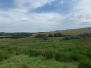
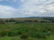
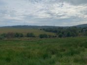
Coelbren Camp is a large rectangular camp lies some 660 feet (c.200 m) south-east from the Coelbren auxiliary fort. Its major axis is aligned to the north-north-west and the crossing of the Afon Pyrddin. The outline is slightly trapezoidal, its southern defences being somewhat shorter than those on the north. Almost the complete outline of its defences has been traced, all apart from the central portion of the western side which has been eroded by a stream, and the south-west angle, although its entire circuit may be easily extrapolated. There is an entrance set in the centre of the southern rampart and another centrally-placed gap in the in the western defences may also be a gateway; no other entrances are visible.
It appears likely that this temporary marching camp was the first Roman military establishment in the area and may by dated to the campaigns of the governor Quintus Veranius. The camp at Beulah near Caerau in Powys (SN9150) possibly dates from the same campaigns (see Webster).
References for Coelbren Camp
- An Inventory of the Ancient Monuments in Glamorgan by the RCAHMW (HMSO, Cardiff) vol.1, part ii, p.99 & fig.54;
- Rome Against Caratacus by Graham Webster (Batsford, London, 1993) fig.37, p.106.
Map References for Coelbren Camp
NGRef: SN8610 OSMap: LR160
OS National Grid Reference: SN862102
Dimensions: 1,436 x 1,090 (1,000) ft (438 x 332 (305) m)
Area: c.34½ acres (c.14 ha)
Roman Roads near Coelbren Camp
None identified
Sites near Coelbren Camp
- Coelbren Roman Fort (1 km)
Flavian Auxiliary Fort (AD 69–96) - Hirfynydd Ridge Fortlet (5 km)
Fortlet and Signal Station - Craig y Ddinas Hillfort (Ystradfellte) (6 km)
Iron Age Hillfort and Iron Age Promontory Hillfort - Ystradfellte Marching Camp (9 km)
Marching or Temporary Camp - Carn Caca (Melin Court Brook) Marching Camp (11 km)
Marching or Temporary Camp - Blaen-Cwmbach Marching Camp (13 km)
Marching or Temporary Camp - Neath (Nidum) Roman Fort (17 km)
Flavian Auxiliary Fort (AD 69–96) and Milestone - Neath (Nido) Vicus (17 km)
Minor Settlement - Arhosfa'r Garreg-lwyd (17 km)
Marching or Temporary Camp - Maendy Camp (18 km)
Iron Age Hillfort