Hadrian's Wall - Fort - Newcastle (Pons Aelius)
Hadrian's Wall Fort and Roman Bridges
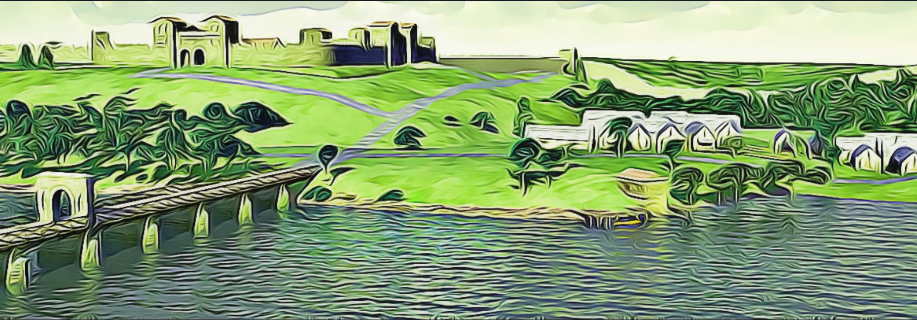
Pons Aelius – ‘The Aelian Bridge’
When the emperor Hadrian visited Britain in 122AD and the need for a continuous northern frontier wall was first envisioned, the eastern terminus was to be marked by a fort at the first crossing point of the River Tyne, at Newcastle. A new bridge was built here to carry the road from the existing fort at Concangis (Chester le Street, Durham), and was called Pons Aelius after the emperor’s family name, which title was – over a period – transferred to the fort itself. The only evidence we have for the Roman name comes from the Notitia Dignitatum of the 4th/5th century (vide infra). The Newcastle fort was not to mark the wall’s oriental end for long, however, as an extension eastwards to another fort at Segedunum (Wallsend, Tyne & Wear) was started before the wall had been completed westward beyond Cilurnum (Chesters, Northumberland).
There are eleven inscribed stones recorded in the R.I.B. for Newcastle, four of them added since the work was first published. There are seven altarstones, a statue or altar base dedicated to the emperor’s mother (RIB 1322c), a relief depicting a triad of goddesses (1318), and two building inscriptions, one of which records the restoration of the bath-house (1322d), and another recording the arrival of troops from the continent (RIB 1322; discussed below). Many of the texts from these stones are shown here.
The Auxiliary Fort and Bridge
The praetorium and principia of the Hadrianic fort at Pons Aelius were recently found in the grounds of the castle adjacent to the Castle Keep, the castle being built directly upon the site of the former Roman encampment. Originally built c.122AD to mark the eastern terminus of the Wall, the fort at Newcastle is quite small and was sited here to guard the important river-crossing, the first major encampment being nearby at Condercum (Benwell, Tyne & Wear). The unit which comprised the original garrison of the fort is unknown, however, a recently unearthed stone dedicated to the empress Julia Domna and dated to c.213AD, gives the name of the unit then stationed at Newcastle, and the Notitia Dignitatum provides the name of the late-fourth century garrison. Another recently-discovered inscription records the building or restoration of a bath-house which evidently stood outside the Newcastle fort.
The Roman bridge had two stone abutments and, although only two piers have so far been located, it is estimated that there were originally ten. The pier found in 1872 was 16 feet wide and 20 feet long with cutwaters both upstream and down to cope with the tidal nature of the Tyne at this point in its course. The pier caisson was constructed from closely-set, iron-shod oak piles, with the internal space filled with stone rubble. The total length of the Roman bridge from bank to bank is estimated to have been 735 feet.
There are a number of small tributary streams of the Tyne which must have passed through culverts beneath the Wall. The Pandon Burn emptied into the Tyne some 150 yards downstream from the Roman bridge near the Custom House, and the substantial Ouse Bourne confluence lies over ¾ mile further downstream. Another small stream named the Skinner Bourne entered the Tyne just over 300 yards upriver from the site of the Roman bridge beyond the Mansion House, and another named the Lort Burn lay to the east about 1/3 of the distance between the Pandon and Ouse Burn confluences.
The Military Units
Legio Sextae Victrix Pia Fidelis The Sixth Victorious Legion, Loyal and Faithful
Legio VI Victrix is mentioned on two altarstones dredged up from the Tyne, one dedicated to Oceanus and the other to Neptune, both powerful water deities (vide infra). They are also mentioned on a dedicatory inscription which records reinforcements from the German provinces for Legio VI along with the other two British legions, II Augusta and XX Valeria. These supplementary troops were neccessary to bolster the Island’s garrison after losses incurred c.150AD when the northern tribes revolted, and may have arrived in the train of the governor Gnaeus Julius Verus c.158, also mentioned on the stone.
RIB 1322 - Building dedication to Antoninus Pius
For the Emperor Antoninus Augustus Pius, father of his country, the detachment (of men) contributed from the two Germanies for the Second Legion Augusta and the Sixth Legion Victrix and the Twentieth Legion Valeria Victrix, under Julius Verus, emperor’s pro-praetorian legate, (set this up).
NO AVG PIO P
PAT VEXILATIO
LEG II AVG ET LEG
VI VIC ET LEG
XX V V CONR
BVTI EX GER DV
OBVS SVB IVLIO VE
RO LEG AVG PR P
Julius Verus, governor of Britain, about 155-about 159 (Birley in Askew Coinage 81).The composer of the text uses vexillatio collectively for vexillarii, as the subsequent contributi plainly shows. He also uses the masculine duobus to agree with Germaniis. The mason has omitted one l in vexillatio, and t and the first i in contributi. Addenda from RIB+add. (1995): The mason also omitted R in pr(aetore). When detachments were drawn from more than one legion, the plural was used: vexillarii or vexillationes. In normal usage vexillatio followed by the name of a unit means a detachment of [not ‘for’] that unit. (In the context of Julius Verus’ governorship, when there was trouble in northern Britain, this creates a problem.) Wilkes notes that vexillarii is the earlier term; this seems to be the first epigraphic instance of vexillatio, and confusion may have resulted. There have been four attempts to emend or explain: i. ex(ercitibvs) ger(manicis) dvobvs Wilkes, ‘(contributed) to the two German armies’. ii. Birley Fasti, citing Wilkes but understanding ‘(contributed) from the two German armies’. iii. by haplography (ex) ex(ercitibvs) ger(manicis) dvobvs Bogaers, ‘(contributed) from the two German armies’, re-stated by Frere, but dismissed as far-fetched by Haverfield in EE ix. iv. ex(ercitibvs) ger(manicianis) dvobvs Speidel, ‘(contributed) to the two German armies’ [and now returning], a possibility noted by Wilkes but thought to conflict with con(t)r(i)buti. (iv) is the best compromise so far between the natural sense of the Latin and the historical context. It requires a previous troop-movement (from Britain to Germany), but Speidel can argue from ILS 1071 and AE 1924, 74 that a second army had been temporarily concentrated in Upper Germany. This would have been after the completion of the Antonine Wall, when northern Britain was peaceful. However, note that although ex for exercitus (singular) is found in brick-stamps, the extreme and ambiguous abbreviation ex for exercitibus seems to be unparalleled in monumental inscriptions; one would have expected at least exx or exer.
Cohors Primae Cornoviorum – The First Cohort of Cornovii
At the beginning of the fifth century the The Notitia Dignitatum records that Cohors I Cornoviorum was stationed at Pons Aelius; they were raised from among the Cornovii tribe who inhabited Cheshire and Shropshire, and were the only native British unit known to have been stationed on the wall.
A stone tablet was found on the south side of Hanover Square in Newcastle that records the work of Cohors I Thracum on the vallum (RIB 1323), but it is thought unlikely that this unit was ever permanently stationed here.
RIB 1316 - Altar dedicated to Jupiter Optimus Maximus
To Jupiter, Best and Greatest, for the welfare and victory of the Emperor.
PRO SALV
TE ET VICTOR
IA AVG
No commentary.
RIB 1321 - Altar dedicated to Silvanus
To the god Silvanus Gaius Valerius [set this up].
SILVANO
G VAL ❦
[...]
No commentary.
RIB 1318 - Dedication to the three Mother Goddesses
To the Mother Goddesses of his native land from overseas Aurelius Juvenalis made this offering.
MATRIBVS TRAMARINIS
PATRIS AVRELIVS IVVENALIS
S
No commentary.
RIB 1319 - Altar dedicated to Neptune
To Neptune the Sixth Legion Victrix Pia Fidelis (set this up).
VI VI
P F
This altar and its counterpart (RIB 1320) were set up in a shrine on the Tyne bridge when it was first built at the point where the river, under Neptunus, met the tidal waters, under Oceanus, where the protection of both deities was required. Mowat (loc. cit.) comments on the absence of inscriptions to Oceanus, and quotes Arrian (Indica 18, 11) for the sacrifice to Poseidon and Oceanus among other gods by Alexander the Great. See also RIB 662, 663.The bridge, Pons Aelius, named after Hadrian and designed as the original starting-point of Hadrian’s Wall (NCH xiii 507), must belong to the inception of the Wall in A.D. 122. This was the year of the arrival in Britain of Legio VI Victrix, the dedicator and presumably the builder of the bridge R.P.W. Addenda from RIB+add. (1995): For photographs see Caplan, Arch. Ael. 5th Ser. 4 (1976), 171-6 with Pl. VIII, who discusses the cults of Neptune and Ocean.
RIB 1320 - Altar dedicated to Ocianus
To Ocianus the Sixth Legion Victrix Pia Fidelis (set this up).
VI VI
P F
For its counterpart see RIB 1319.Ociano: a variant for Oceano. Addenda from RIB+add. (1995): For photographs see Caplan, Arch. Ael. 5th Ser. 4 (1976), 171-6 with Pl. VIII, who discusses the cults of Neptune and Ocean.
Whilst there was a substantial Roman presence at Newcastle for nearly three centuries, whatever evidence was left behind now lies buried beneath the modern city streets, and nothing much now remains to be seen. Since the Wall was made a World Heritage site, there has been a surge of archaeological interest in the Wall and its environs, which has resulted in the discovery of the first recorded milecastle at Westgate Road (see below).
- The Roman bridge: was built of timber with ten masonry piers and two abutments, and lay on the same line as that of the present swing-bridge to Gateshead, built in 1872.
- The Auxiliary fort: has only recently been discovered, the remains of the praetorium and principia were uncovered beside the castle keep, and the rest of the fort lies buried beneath the castle. It would appear from dimensions of the recovered remains that the fort itself was quite small.
- The Wall itself: passed just to the north of the Roman Catholic cathedral (built in 1841) in the centre of the city, roughly followed the line of the modern A187 eastwards, and is buried beneath the A6115 to the west.
- The Vallum: is first apparent at Arthur’s Hill, about a mile west of the town centre.
Pons Aelius Related Links
References for Pons Aelivs
- Hadrian’s Wall Map and Guide by the Ordnance Survey (Southampton, 1989);
- Hadrian’s Wall in the Days of the Romans by Ronald Embleton and Frank Graham (Newcastle, 1984) pp.47-51;
- The Roman Inscriptions of Britain by R.G. Collingwood and R.P. Wright (Oxford 1965).
Roman Roads near Pons Aelivs
Wrekendike: S (8) to Chester-le-street (Chester-le-Street, Durham) Wall: W (2) to Condercvm (Benwell, Tyne & Wear) Wrekendike: E (12) to Sovth Shields (South Shields, Tyne & Wear) Wall: E (3) to Segedvnvm (Wallsend, Tyne & Wear)
Sites near Hadrian's Wall - Fort - Newcastle (Pons Aelius)
- Hadrian's Wall - Milecastle 4 - Westgate Road (1 km)
Hadrian's Wall Milecastle - Hadrian's Wall - Milecastle 5 - Quarry House (1 km)
Hadrian's Wall Milecastle - Hadrian's Wall - Milecastle 3 - Ouseburn (2 km)
Hadrian's Wall Milecastle - Hadrian's Wall - Milecastle 6 - Benwell Grove (3 km)
Hadrian's Wall Milecastle - Hadrian's Wall - Milecastle 2 - Walker (3 km)
Hadrian's Wall Milecastle - Temple of Antenociticus (3 km)
Roman Temple Or Shrine - Hadrian's Wall - Fort - Benwell (Condercum) (4 km)
Bath House, Hadrian's Wall Fort and Vicus - Benwell (Condercum) Vallum Crossing (4 km)
Hadrian's Wall - Benwell (Condercum) Vicus (4 km)
Vicus - Hadrian's Wall - Milecastle 1 - Stott's Pow (4 km)
Hadrian's Wall Milecastle