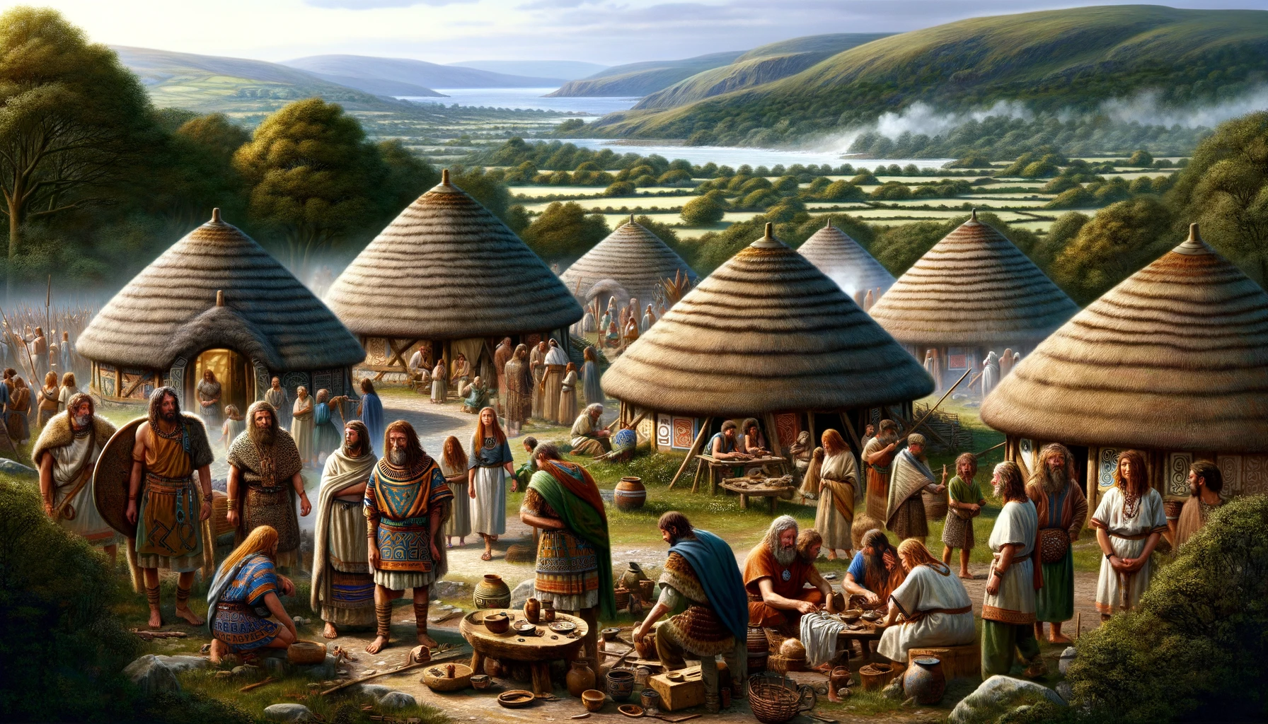
The Deceangi were an Iron Age tribe in the British Isles prior to the Roman invasion of Britain. This tribe is conspicuous in that they are not mentioned in the Geographia of Ptolemy. The Deceangi tribal territories lay in the extreme northern coastal region of Wales; modern north-west and north-east Clwyd and northern Gwynedd. Living mainly in hillforts, the tribe had no self-governing institutions and no Romanized capital and as a consequence were probably subject to Roman military rule.
The Civitas Deceangorum? The Principal Tribal Centre
As already noted, the tribe had no self-governing institutions and no readily identified Romanized capital and, like their southern neighbours the Ordovices, were probably placed under military government following the initial campaign of governor Julius Agricola in 78AD. This cavalry fort on the Afon Conwy was the largest Roman military installation in the canton and it is possible that the administrative functions of the tribe were conducted from here. On this basis, the minor settlement or vicus outside the fort may possibly be construed as the Deceangi, but it is almost certain that a Civitas Deceangorum never existed.
Notable Settlements and Military Sites
- Prestatyn(Clwyd) – Fort and minor settlement on the north coast of Wales near the Dee estuary.
- Pen-y-gogarth (Great Orme) (Great Ormes Head, Llandudno, Gwynedd) – There were Roman copper mines on Great Orme’s Head near Aberconwy. There was probably a settlement nearby.
- Pentre Ffwrndan (Clwyd) – A small settlement was probably associated with the Lead/Silver Mines.
- Ruthin(Clwyd) – Fort at the head of the Vale of Clwyd, beside the Afon Clywedog.
- Bryn Y Gefeiliau (Caer Llugwy) (Gwynedd) – Fort on the Afon Llugwy between Betws-y-Coed and Capel Curig in Snowdonia.
Like their Ordovician neighbours, the Deceangli lived mainly in hillforts, notably in a chain of settlements dotted along the length of the Clwydian Range in the eastern part of the tribal lands. From Moel Hiraddug near the mouth of the Clwyd they continue in close succession along the eastern bank of the river; Moel y Gaer (Bodfari), Pen y Cloddiau, Moel Arthur, Moel y Gaer (Llanbedr) and Foel Fenlli. Continuing west along the northern Welsh coastline from the mouth of the Clwyd, we find other Deceanglian forts at Pen y Corddyn, Conwy Mountain at the mouth of the Conwy and Pen y Gaer further inland along the Conway valley, also possibly Dinas Dinorwig overlooking the Menai Straits and Mona Insula.
The Tribal Name
Mentioned in the Classics by Cornelius Tacitus
The most famous reference to this iron-age tribe is without doubt, the passage in Cornelius Tacitus’ Annals of Imperial Rome:
‘By the Icenian defeat all who were wavering between war and peace were reduced to quietude, and the army was led against the Ceangi. The country was devastated, booty collected everywhere, while the enemy declined to risk a battle, or, if he made a stealthy attempt to harrass the marching columns, found his treachery punished. And now Ostorius was within measurable distance of the sea which looks towards Ireland, when an outbreak of sedition among the Brigantes recalled a leader who was firm in his resolution to attempt new conquests only when he had secured the old.’ (Tacitus Annales XII,32)
The tribal name Deceangli is phonetically connected with the Tegeingl district of Flintshire. The cantref of Tegeingl was created by Edward I and extended from the Wepre Brook to the River Clwyd. The lead deposits of the Halkyn Hills were certainly known by the Romans before they arrived in the area, in fact, it would seem that governor Ostorius Scapula made a bee-line for this mining district almost as soon as he took command of the province.
The native villages in Flintshire during the Romano-British period were characterized by collections of circular or rectangular huts with stone footings and thatched roofs surrounded by crudely-built stone enclosure walls. Their preferred location appears to be on or near hill-tops. Many of these sites have been identified; Dinorben above Abergele, Braich-y-Dinas near Penmaenmawr, Tre’r Ceiri in Caernarfonshire, Moel Hiraddug near Rhuddlan, also possibly Moel Arthur in Flintshire and Moel Fenlli and Moel-y-Gaer both on the Flintshire-Denbighshire border.
‘The presence of these hill-sites then testifies to the backwardness of the inhabitants of North Wales as compared with South-East Britain, and to the apparently small effect of Roman influence within its borders.’ (Taylor 1922 pp.63/4)
The Tribal Industries
The Lead/Silver Mines of Flintshire
‘ As pigs of lead have been unearthed in Cheshire and Staffordshire, inscribed DECEANG or the like, it is presumed that the tribe occupied the lead district of Flintshire. Whether the name was Deceangi or Ceangi depends on the unanswerable question whether, in the inscriptions, DE is a preposition or not. Ptolemy’s ?????????? ????? (II.3,3) tells in favour of the second form.’ (LOEB footnote)
The most notable export of the Deceangli tribe was lead and silver, which was mined in the form of the ore Galena, most notably at Pentre Flint. Roman mine-workings have also been identified at Halkyn, and a coin of Gordian III found in the lead mines at Talar Goch near Meliden may point to Roman exploitation of lead there. A possible hypocaust reported at Holywell may indicate occupation in connection with lead-mining, perhaps in an administrative or regulatory role. At least two large pigs of lead – useful by-products of silver extraction – have been found at Deva Victrix (Chester), another far to the east along Watling Street near Letocetum (Wall), also a ship-load turned up on the shores of the River Mersey.
- Found in river gravel in June 1885 at the Roodeye in Chester, 23 ft. beneath the surface and 50 yds. from the present channel of the River Dee, along with potsherds, two skulls and other bones. This lead sow measures 24 ins. long, 5 ins. wide and 4½ ins. thick, and weighs 192 lbs. Inscribed on top are the words IMP¢¬¢VESP¢¬¢AVGV¢¬¢T¢¬¢IMP¢¬¢III, and the word DECEANGI appears on the side beneath (Dated: 74AD).
- Found in 1838 1¼ miles E of Chester’s Eastgate near Tarvin Bridge beside the Roman road to Northwich and Manchester. It measures 24 ins. long, 6 ins. wide and 4 ins. thick, weighing 179 lbs. On the top, was the stamped incription; IMP¢¬¢VESP¢¬¢V¢¬¢T¢¬¢IMP¢¬¢III¢¬¢COS, and again, on the side beneath; DECEANGI (Dated: 74AD).
- Found in 1772 on Hints Common in South Staffordshire (see Letocetum), this pig measures 22½ ins. long, 5¾ ins. wide, and 4 ins. thick, weighing in at 152 lbs. It is inscribed on the top IMP¢¬¢VESP¢¬¢VII¢¬¢T¢¬¢IMP¢¬¢V¢¬¢COS, and on the side DECEA G (dated: 76AD).
- Around 1590, Camden reported the finding of twenty lead sows on the shores of the River Mersey near Halton, all reputedly inscribed IMP¢¬¢DOMIT¢¬¢AVG¢¬¢GER¢¬¢DECEANG (dated: 81-96AD).
Of these, the first two now reside in the Grosvenor Museum, Chester, the Watling Street sow is in the British Museum, London, and the lead pigs found in the River Mersey are all lost.
The Copper Mines of Pen y Gogarth
The copper mines on Great Orme’s Head were probably administered from Canovivm. The more lucrative lead/silver mines may have been within the jurisdiction of the Twentieth Legion based at Deva (Chester).
Bibliographical Links
For further information on the tribal territories of the Deceangli see Roman Flintshire by M.V. Taylor M.A. with a Note on a Road from St. Asaph to Holywell by W.J. Hemp F.S.A. in Flintshire Historical Society Publications Volume IX (1922) pp.58-96
References for The Deceangi
- The Geography of Claudius Ptolemaeus, trans. by E.L. Stevenson (Dover, New York, 1991);
- Atlas of Great Britain by the Ordnance Survey (Country Life, 1982);
- Historical Map and Guide: Roman Britain by the OS (4th Ed., 1990);