Charterhouse Amphitheatre
Amphitheatre
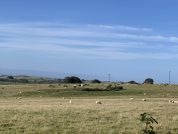
An amphitheatre stood west of the settlement. It is the only one in England to exist at a lead mine and is additional evidence of the importance of Mendip lead to the Romans. It measures 32m x 24.4m and the banks for the seating survive 4.5m above the arena. It was probably a place of entertainment for the soldiers at the Roman fort which was established here.
The earth work was excavated in 1909 by St.George Gray who established two entrances (E-W). He found flints and a fragment of Samian ware found by on the old ground surface beneath the vallum suggests a Roman date for the amphitheatre. No features characteristic of an amphitheatre: from this he concluded a Roman earthwork. A trial trench in 1938, failed to reveal any evidence of an internal ditch. These records were destroyed in 1940, but gave rise to the idea of a post-Roman date. It was thought that the distribution of sherds and flints throughout the earthwork might represent a scraped-up surface yield.
Sites near Charterhouse Amphitheatre
- Charterhouse Fort (1 km)
Auxiliary Fort - Charterhouse Settlement (1 km)
Major Settlement - Charterhouse Mine (1 km)
Lead Mine and Silver Mine - Chew Park Roman Villa (8 km)
Villa - Pagans Hill Chew Stoke Temple (8 km)
Temple Or Shrine - Cadbury-Congresbury Hill Fort (10 km)
Iron Age Hillfort - Congresbury Temple Complex (10 km)
Minor Settlement, Pottery, Roman-Building, Suspected Romano-british Temple Or Shrine and Villa - Gatcombe Roman Settlement (14 km)
Industry and Minor Settlement - Meare Lake Village (15 km)
Iron Age Settlement - Glastonbury Lake Village (16 km)
Iron Age Settlement


